


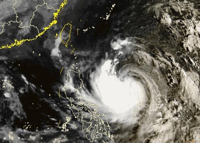
Latest Update on Typhoon Connie: Expected to Make Landfall in Taiwan on the 31st
According to China Weather Network, Typhoon Connie, the 21st typhoon of the year, formed in the northwest Pacific on October 25. It is currently moving west-northwest at 15-20 kilometers per hour and could intensify to super typhoon strength (52-58 meters per second, Category 16-17). Connie is forecast to make landfall along Taiwan's eastern coast between noon and evening on October 31, with sustained winds of 45-52 meters per second (strong typhoon or super typhoon intensity). It will then cross Taiwan and approach the coastal areas of Zhejiang and Fujian provinces while gradually weakening.
Statistics show that since 1949, no typhoon has made landfall or brushed past Fujian and Zhejiang after October 25. Relevant regions should closely monitor the typhoon's trajectory and take preventive measures in advance.
Strong Wind and Rain Forecast
Under the combined influence of Typhoon Connie and cold air, from October 29 to November 2, winds of force 6 to 12 will occur in the Yellow Sea, East China Sea, and northern South China Sea, with gusts reaching force 13 to 17 in some areas. From October 30 to November 1, heavy to torrential rains will affect Taiwan Island, Fujian, and Zhejiang, with localized extreme rainfall potentially reaching 500-1200 millimeters. Rainfall in Taiwan will peak during the night of October 30 to 31, while Fujian and Zhejiang will experience the heaviest precipitation from October 31 to November 1.